
Utility surveying and pipe tracing before you excavate

Buried services records are indicative, not surveyed — and depth is frequently missing or wrong. We establish what is actually under a site, and how confident anyone should be in that answer, before a bucket goes in the ground.

Burst pipe or major leak?Call 0800 520 0043

The service

The drawing is a starting point. It is not a survey.

Statutory records show the approximate horizontal position of buried apparatus. They routinely say nothing reliable about depth, they are frequently wrong about route on older networks, and they will not show services that were installed privately, abandoned in place or diverted without the record being updated.

That matters because striking a buried service is expensive in every direction at once: the damage, the supply interruption, the delay, the charge back from the utility, and — with electricity or gas — a genuine risk of serious injury. HSE guidance on avoiding danger from underground services expects the position of apparatus to be established before excavation, not discovered during it.

We trace and survey what is actually there. Records first, then electromagnetic and radar detection on site, then verification by careful exposure where a design or a bore genuinely depends on knowing the answer rather than estimating it.

What we do

Records, then detection, then proof.

Each stage costs more and tells you more. The skill is knowing which level of confidence a given decision actually requires.

Open trench showing buried pipework of the kind located during a utility survey
Desk study and walkover
01

Records review and site reconnaissance

We obtain the available utility records and walk the site against them, noting chambers, covers, hydrants, marker posts, stop taps and surface evidence of past excavation. That combination catches the obvious conflicts cheaply and, just as usefully, identifies where the record and the ground plainly disagree.

  • Utility records obtained and collated for the site
  • Site walked and visible apparatus recorded
  • Discrepancies between record and ground flagged early
  • Scope for the detection survey set from what the review finds
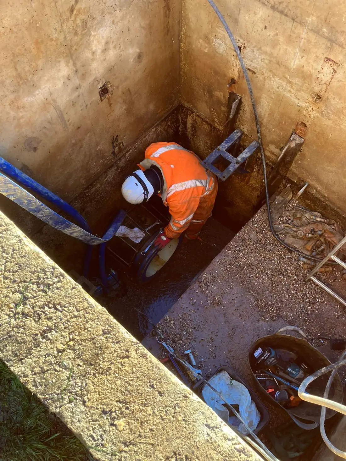
Cascade Water Services engineer accessing an underground chamber during a utility survey
EML and radar
02

Detection on site

Electromagnetic locating finds conductive services and anything carrying a traceable signal — which covers most metallic pipes and cables, and plastic pipe fitted with a tracer wire. Ground penetrating radar picks up features that carry no signal at all, including plastic pipe and ducts, though its performance depends heavily on ground conditions.

  • Electromagnetic locating for conductive and signal-carrying services
  • Radar for non-conductive services such as plastic pipe and ducts
  • Positions marked on the ground and recorded to plan
  • Depth estimated and reported with its confidence stated
Trial hole opened to verify the position and depth of a buried service
Estimated vs verified
03

Verification where it matters

Detection gives you a position and an estimated depth. Where a design, a mole shot or a piling layout depends on the answer being right, the only way to be certain is to expose the apparatus carefully and measure it. We verify at the points that matter rather than pretending an estimate is a measurement.

  • Careful exposure at critical points to confirm position and depth
  • Verified positions recorded to survey accuracy
  • Findings issued as a marked plan you can design against
  • Clear statement of which positions are verified and which are estimated

Why Cascade

A survey is only useful if it states its own confidence.

The dangerous survey is not the inaccurate one. It is the one that presents an estimate as though it were a measurement.

  1. 01

    We say what is verified and what is not

    Every position is reported with the confidence behind it. A detected depth and an exposed depth are different things, and a plan that blurs them invites exactly the strike it was commissioned to prevent.

  2. 02

    We are the people who then dig

    Thirty years excavating around live services means the survey is scoped by people who will have to work to it, not by a surveyor who never returns to the site.

  3. 03

    Water infrastructure is our specialism

    Tracing water mains and supply pipes — including plastic runs with no tracer wire, which are the hardest to find — is core work rather than an adjacent service.

  4. 04

    Surveys sized to the decision

    A records review is enough for some questions and useless for others. We will tell you when you need verification and, equally, when you do not.

  5. 05

    Pre-qualified for site access

    SafeContractor, SMAS Worksafe, Acclaim, Constructionline Gold and Achilles UVDB Silver Plus, so getting us onto a live site is straightforward.

  6. 06

    One organisation through to the works

    If the survey leads to a diversion, a connection or a moled installation, the same team carries it out with the survey already in hand.

Independently assessed

Full accreditation detail on the about page.

Technical detail

How confident is the answer?

PAS 128 exists because "we surveyed it" means very little on its own. It grades a survey by how the information was obtained, which is what makes one plan comparable to another.

Survey framework
PAS 128
The specification for underground utility detection, verification and location. It defines quality levels so a plan states how each position was established rather than presenting everything with equal apparent authority.
Quality level D
Records only
Desktop utility records search. Cheapest and least certain — indicative horizontal position, usually no reliable depth, and nothing at all about unrecorded apparatus.
Quality level C
Records + site
Records reconciled against visible site evidence: chambers, covers, marker posts and surface features. Improves confidence in route without any detection equipment.
Quality level B
Detected
Geophysical detection using electromagnetic locating and radar, with positions marked and depths estimated. This is the level most site work is designed against.
Quality level A
Verified
Apparatus physically exposed and measured, giving the highest confidence in both position and depth. The only level at which a depth is a measurement rather than an estimate.
Safe digging guidance
HSG47
The HSE guidance on avoiding danger from underground services. Its expectation is plans, locating devices and safe digging practice used together — no one of the three is sufficient on its own.
  • Plastic pipe is the hard case

    Polyethylene carries no signal for an electromagnetic locator unless a tracer wire was installed with it, and many were not. Radar can find it, but performance falls away in wet clay and made ground — which is exactly where plastic water pipe tends to be buried.

  • Detected depth is an estimate

    Electromagnetic depth readings are calculated, not measured, and they are affected by adjacent services, signal distortion and how the signal was applied. If a design depends on the depth, verify it.

  • Records will not show what nobody recorded

    Private supplies, site services, abandoned apparatus and undocumented diversions appear on no statutory record at all. On former industrial or institutional sites they are common, and detection is the only way to find them.

  • A survey has a shelf life

    Marks wash off, and sites change. A survey carried out months before the works, on a site where other contractors have since been active, should be re-established before excavation rather than trusted from a folder.

Benefits

What knowing beforehand is worth.

  • 01

    Strikes avoided

    The damage, the supply interruption, the delay and the utility’s charge back all cost more than the survey that would have prevented them — and that is before anyone is hurt.

  • 02

    Safer excavation

    Electricity and gas strikes injure people. Establishing position before digging is what HSE guidance expects, not an optional refinement.

  • 03

    Designs that survive the ground

    Foundations, piling layouts and duct corridors set around apparatus that is actually there, rather than around a record that turns out to be wrong.

  • 04

    Moling that reaches the other pit

    A mole holds a straight line and cannot be steered around an obstruction. Proving the route is the difference between a clean bore and a stopped one.

  • 05

    Fewer programme surprises

    Unrecorded apparatus found at survey stage is a design adjustment. Found by an excavator, it is a stoppage, an investigation and a diversion.

  • 06

    A defensible record

    A plan stating how each position was established, useful for the works, for the client and if anything is ever questioned afterwards.

Common questions

Before you enquire.

The questions we are asked most often about this service, answered without the sales gloss.

See all FAQs
Are utility records not good enough on their own?

No. Statutory records show approximate horizontal position and rarely give reliable depth. On older networks the route itself is often wrong, and no record will show private supplies, site services or apparatus abandoned in place. They are a starting point for a survey, not a substitute for one — and they should never be designed against as though they were surveyed.

What is PAS 128 and why does it matter?

It is the specification for underground utility detection, verification and location. It defines quality levels — D for records only, C for records reconciled with site evidence, B for geophysical detection, A for apparatus physically exposed and measured — so a survey states how each position was established. Without that, every line on a plan looks equally reliable when they are not.

Can you find plastic water pipes?

Often, but it is the hardest case. Polyethylene carries no signal for an electromagnetic locator unless a tracer wire was installed alongside it, and many older runs have none. Ground penetrating radar can pick up plastic pipe, though its performance drops in wet clay and made ground. Where a plastic run is critical, verification by careful exposure is the reliable answer.

Is a detected depth accurate?

It is an estimate, not a measurement. Electromagnetic depth readings are calculated from the signal and are affected by nearby services, distortion and how the signal was applied. They are perfectly good for planning a trench. If a foundation, a piling layout or a mole shot depends on the depth being right, it should be verified by exposing the apparatus.

Do I need a survey for a small job?

It depends on what you are digging into, not how big the job is. A shallow excavation in a known garden is a different proposition from breaking a footway where electricity and gas share the corridor. HSE guidance expects plans, locating devices and safe digging practice to be used together — and one strike costs more than any survey we would have quoted.

How long does a survey stay valid?

Surface marks wash away within weeks, and sites change — other contractors dig, services get installed, and ground gets disturbed. A survey carried out well before the works should be re-established on the ground before excavation rather than relied on from a folder several months later.

Survey enquiry

Tell us what you are about to dig, and how deep.

The location, the excavation you are planning and what it is for are enough for us to say which level of survey the decision actually needs — including when a records search would do.

Or reach us directly

Burst main or major leak? The freephone line is answered 24 hours a day.

Request a quote

Site layouts, utility drawings, correspondence or photos of the problem. Up to 5 files, 15MB in total — PDF, JPG, PNG, HEIC, DWG or DXF.

We use these details to answer your enquiry and nothing else.